torsdag den 29. juni 2006

Vestamager and mobile organic gardens

The next walk will be a dusk tour on Thursday, 29 June 2006. We shall start at 8.30 pm from the Vestamager metro station. Here we shall visit Ørestad’s mobile organic gardens and have a look at what else is going on in the district. The walk will end at Islands Brygge, where from the 13th floor at the top of a converted concrete silo one can get a view over the whole of Copenhagen, see the sun setting and giving a pink hue to Kødbyen’s white buildings from the Thirties, see the neon advertisements on City Hall Square emerge and catch a glimpse of Barsebäck’s grey silhouette if one so wishes. For the same reason: remember to bring binoculars!

The walk is organised together with Netværk for social og politisk kunst i offentlige rum [Network for Social and Political Art in Public Space].


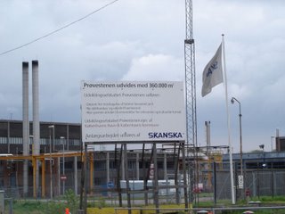
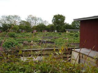
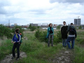
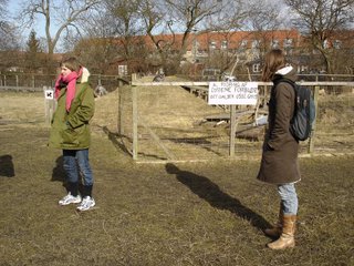
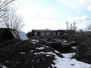
Vestamager is the end station on the metro line, and in the tradition for planning urban development with infrastructure the district will be densely built up in years to come. We saw the mobile organic gardens, where 99 lots can be rented for 200 kroner a year each. Every year the soil is harrowed, and the gardens are redistributed and can then be moved in step with the development of Ørestad.


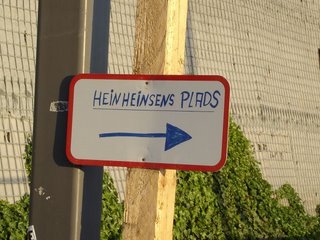
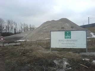
We continued to "Hein Heinsen’s Square", a sculpture that the Danish Arts Foundation’s Committee for Visual Arts has funded together with two other sculptures in Ørestad, all created by elderly Danish men.


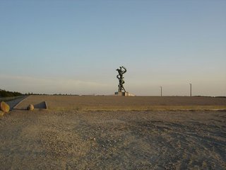
The sculpture stands where the town ends and establishes a radical difference. In as much as it also resembles something that has been dropped out of the sky, it adds a new dimension to the concept of drop sculpture.


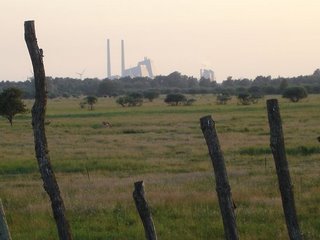
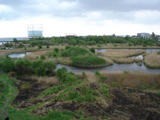
The Common is still one of the most unique free areas in Copenhagen. However, the Avedøre Power Station puts things in perspective and ensures that one does not feel brought back to the Golden Age of Danish painting.


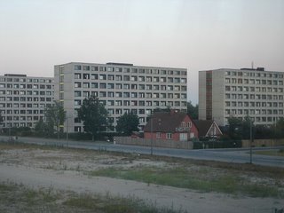
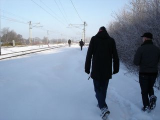
The meeting between different kinds of housing, the natural surroundings and the city is one of Amager’s greatest qualities.


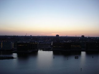
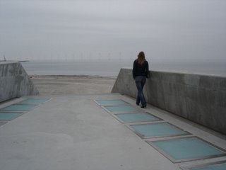
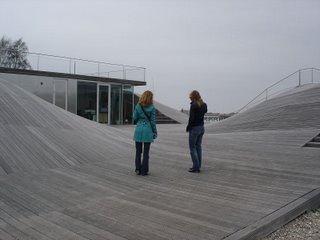
We ended on the roof of a silo by the waterfront, which has now been converted into apartments, one of the few places from which one has a view over the city.

Walked by:
Karen Lisbeth Kristoffersen and Hanne Lindstrøm from Netværk for social og politisk kunst i offentlige rum, Rikke Luther, Alec Due and Nis Rømer

lørdag den 27. maj 2006

By kayak round Prøvestenen


Fences and entry forbidden signs couldn’t be allowed to stop us, so we rented a couple of kayaks and set out to row round Prøvestenen. Since Prøvestenen is used to receive big tankers bringing oil to Copenhagen and for deposits of ”lightly polluted soil”, the placing of Amager Strandpark just next to it is fairly unique. The channel on the Amager side is so shallow that once can almost wade through it, but the kayaks could just slip through. A huge sewage pipe under the road out to Prøvestenen (which can be seen on the map) leaves room to pass underneath and into the industrial port, from which coal, among other things, is shipped into Copenhagen. The first section has a wealth of birdlife. Over on Prøvestenen we could see caravans and scrapped vehicles along the waterside as if there were people living there. Out in the Sound the waves got higher and we rowed between industrial installations and piers, the function of which we could only guess at. The outermost part had just been completed – a huge pier with rectangular yellow pontoons every ten meters presented a surrealistic mooring for oil tankers and other ships. The windmills further out and the planes landing and taking off in Kastrup contributed to the freaky atmosphere.


Rowed by Pia Rönicke and Nis Rømer.

søndag den 21. maj 2006

Prøvestenen and the surrounding district in particular

Prøvestenen is the part of the Port of Copenhagen designed for the reception of oil tankers and the depositing of lightly polluted soil. A new deep-water quay is being excavated to receive even bigger oil tankers. There is a relatively large artificial island in the harbour, originally established as a fort and later used as an oil port (history). On our last walk we heard about an allotment association just next to it with a communal kitchen garden, which we will probably make a detour to. We also hope to receive a visit from a couple of artists from Chicago, who have worked with urban development and urban farming.


Meeting-point: Lergravsparken Metro Station

Date and time: 21 May, 2006, 11 am.


The landscape never ceases to surprise us, which also holds true of this walk. It had originally been planned to take us to Prøvestenen. The area was however fenced in with signs saying that taking photographs was forbidden.


There are major extensions in progress on the island, which once formed part of Copenhagen’s defences but is now used for industry, to receive oil tankers and as a storage site for “lightly polluted earth”. The position of Prøvestenen, so close to the city centre and right next to Amager Strandpark is rather interesting and certainly invites further investigation, perhaps from the water.


Instead we walked along the coast towards the town. The fencing in the area is very substantial – also around the allotment association with the communal kitchen garden that we mentioned in our last report. Seen from the outside it was now a fantastic place. People were digging and planting, and everything was fertile and fragrant. The sheds along the waterfront for a sailing club were also extremely active, and there was a general sense of activity and of the landscape being used, something one doesn’t see much of in the city on a Sunday morning.


In a wild and untamed area we encountered some caves dug into an undulating terrain. Somebody had clearly invested a fair amount of energy in creating a small fortress. The floor of the woods was strewn with blue bullets with a mother-of-pearl surface that made one think of the excrement from some fantasy animal.


From a nearby mound we were regarded through binoculars by men in camouflage clothes. Later we found out that they were looking out for fellow combatants for a softgun battle.


The area is extraordinarily beautiful and has masses of birdlife, but the site is said to be one of the most polluted in the country because of the enterprises that were once situated there. It is ironic that the pollution may be one of the only things that can prevent the area from being built up with far too expensive apartments.


Walked by:

Daniel Tucker, Emily Forman, Dot Nielsen, Pia Rönicke and Nis Rømer.

søndag den 23. april 2006

A walk around Amager in cloudy weather

On the first spring walk we looked at Amager Strandpark, among other places, and how it has affected the area and the shoreline.


Amager Beach, which was once Copenhagen’s quite special paradise, has now been taken over by a huge shithole of a manmade beach. Amager Beach was perhaps a little rough formerly, but the slightly too shallow/malodorous beach was enjoyed by many of the glad users of Helgoland. Helgoland (1925-1994) (the turquoise green building with open-air bathing for children and separate sections for men and women) was the essence of charm and Copenhagen’s answer to the most exotic south sea shore. After a pleasant day of sunbathing one could sit in the café with the coloured lamps and watch the planes landing and taking off. The smell of salt water mixed with windmills, the big gasometer could carry one away to a different place. But Helgoland had to give way to the artificial beach and was demolished in the late summer of 2004. It is said that a new bathing establishment will be built as compensation for Helgoland, but one can still not see any sign of it by the new Amager Beach.


On our walk we also made other good finds: luxury flats (with a few defects like crumbling bricks and rotten windows), something that looked like bunkers by the new beach, but turned out to be changing-rooms and toilets.


The maritime youth house, designed by the architectural firm PLOT, the yacht harbour and Pia’s sausages (we think that there might be a basis for a café latte outlet).


Go there and see for yourself, and try the new beach, and if you get tired of it, go back towards Lergravspark Metro Station. That will bring you across the disused Amager railtrack. Take a little walk down the track and you will enter a quite different world.

fredag den 7. april 2006

Organisation, Frederikshøj and further.


Together with Fri Klasse [Free Class] we went for a walk in Allotment Association Frederikshøj. This is a historic moment because a local plan is at present being adopted for the area, which has existed in a legal limbo since the first residents occupied the area at the beginning of the 1920s.


We met Birthe and Jens, who both live there, and heard from Jens, among others, how the first residents had built houses of wooden crates from Ford and Citroen nearby. The cars were sent to Sydhavn in big crates of first-class wood. An almost symbolic mix of the things that have created the basis for the city we know today: motor traffic, industrialisation and a housing shortage.


Birthe told us how the low rent meant that there was a high level of service in the association, for instance a scheme in which the residents cooked for new parents in the first weeks after the arrival of their baby. However, legalisation is threatening the special qualities of the association, and there is a risk that it will be impossible to protect the area from speculation, something that has been avoided so far by having an internal price system based on the value of the materials used. At the same time, as often happens in such areas, it is now impossible for outsiders to move in, as the external waiting lists have been closed.


Where Garden Association Frederikshøj is extremely well organised with a lot of committed and politically conscious residents who have virtually created their own community, the situation is somewhat different in what is popularly called Shitditch and the Gold Coast nearby. One can’t actually see whether the area is in a state of dissolution or is being built up – probably it’s all happening at the same time.


Today when everything seems to be a matter of positive equity and speculation to such a degree that every landscape or urban scene is seen through ”a predator’s eyes” with a view to speculation and financial possibilities or lack of them, it is important to find geographies that form holes in the capitalist market’s normalisation and standardization. In many ways the walk highlighted a number of very relevant aspects of exclusion, social rights and forms of organisation, and of how the shaping and organisation of the city play an important role for these factors.


lørdag den 25. februar 2006

Fields and the Common

...Via Center Boulevard one can come to Indvej, and perhaps all the way to Skydebanevej. The Home Guard and perhaps the army have a firing range and an explosives-testing area here. And then there is the refuse dump. By the seashore there is a good view of Tippen. And then there are plans for golf courses and more homes. Among other things, there may be a couple of 80-meter high apartment blocks, which Copenhagen Airport is strongly opposed to. But it appears that there will be more of that sort of thing from Fields in the direction of West Amager; some of the buildings there are Telia’s and other server buildings. Unfortunately we probably won’t be able to get in there – it looks pretty fantastic, a server room. Amager beach is in the other direction, but it is a very long walk on the other side of Kalvebod Common with a fantastic bird watch tower. Well, we can go out there if we want some natural surroundings.

Meeting-point: Ørestad Station.

Date and time: Saturday, 25 February 2006, 11 pm.


Shopping as a state of nature seems to be the underlying agenda at Fields (the shopping centre). We looked for signs of personal modifications or otherwise unintended behaviour in the centre, but found very little: a mannequin with trousers half-way down.


We found quite different traces of frivolity on the Common. In summer one often sees naked men and women come out of the bushes on the Common. There’ll be less room for that after a golf course has been built on a large part of the area. Perhaps, when that happens, one could introduce homogolf out of respect for the history of the place.


lørdag den 28. januar 2006

The tracks by Nørrebro Station

Hidden behind Føtex by Nørrebro Station lies the largest unused area in Nørrebro. This is both fantastic and strange since Nørrebro is the most densely populated area in Copenhagen. True, the site is polluted, as it is former Danish State Railways terrain, but it is a good place for looking at the city’s downside – or doing things that one doesn’t want seen...

Meeting-point: start at the corner of Borgmestervænget and Mimersgade at Nørrebro (close to Nørrebro Station).